
Quick Answer
The Everest South Col route is the classic climbing route from Nepal. It begins with the trek through the Khumbu region to Everest Base Camp, then climbs through the Khumbu Icefall, Camp 1, Western Cwm, Camp 2, Lhotse Face, Camp 3, Yellow Band, Geneva Spur, South Col Camp 4, the Balcony, South Summit, the Hillary Step area and finally the summit of Mount Everest.
It is one of the most common commercial climbing routes on Everest and follows the general line used in the first successful ascent by Edmund Hillary and Tenzing Norgay in 1953.
But classic does not mean easy. The south side has mature logistics, but it also has the Khumbu Icefall, Lhotse Face, death zone exposure, crowding, weather windows and the long physical cost of high altitude climbing.
Where the South Route Begins
The south route does not begin with a sudden climb from the foot of the mountain. It begins with a long approach through Nepal’s Khumbu region.
Most teams fly from Kathmandu to Lukla, then trek through:
- Lukla
- Phakding
- Namche Bazaar
- Tengboche
- Dingboche
- Lobuche
- Gorak Shep
- Everest Base Camp
This approach is also the famous Everest Base Camp Trek. For climbers, it is part of acclimatisation. Many people first understand the seriousness of Everest not on a rope, but during those early days of poor sleep, reduced appetite and the slow pressure of altitude.
Everest Base Camp
South Everest Base Camp sits at about 5364 metres near the Khumbu Glacier. During the spring climbing season, it becomes a temporary mountain town of expedition tents, kitchens, communications equipment, medical support, Sherpa teams and supplies.
Base Camp is not a comfortable campsite in the ordinary sense. It is cold, dry, windy and set on glacial terrain. Climbers often live here for weeks while they acclimatise, check equipment, wait for route conditions and prepare for rotations up the mountain.
On the Nepal Everest climbing route, Base Camp is the expedition headquarters. The real climb starts above it.
The Khumbu Icefall
The first major obstacle above Base Camp is the Khumbu Icefall. It lies between Base Camp and Camp 1 and is one of the most famous and feared parts of the south side route.
The Khumbu Icefall is a moving glacier filled with ice towers, crevasses, snow bridges and shifting blocks. Each season, specialist teams prepare a route using ladders, fixed ropes and marked passages.
Even with fixed ropes, the Icefall remains dangerous. The glacier moves. Seracs can collapse. Crevasses can widen. Climbers usually pass through early in the morning when temperatures are lower and the ice is relatively more stable.
Many climbers regard the Icefall as one of the most serious objective hazards on the south side. It is not a place solved by motivation alone. It requires speed, judgement, route maintenance and some luck.
Camp 1
After crossing the Khumbu Icefall, climbers reach Camp 1 at roughly 6060 to 6100 metres. It sits near the entrance to the Western Cwm.
Camp 1 is usually a transition camp rather than a comfortable place to stay. The surrounding terrain is glaciated, crevassed and exposed to dramatic temperature swings. Sunny daytime conditions can feel surprisingly hot, while nights turn cold quickly.
Its main purpose is acclimatisation and movement. Many teams continue toward Camp 2 or use Camp 1 as part of a rotation.
Western Cwm and Camp 2
From Camp 1, the route crosses the Western Cwm toward Camp 2. The Western Cwm is a broad glacial valley surrounded by Everest, Lhotse and Nuptse.
It may look relatively gentle, but it can be deceptive. On sunny days, reflected heat from snow and ice can make it feel extremely hot. At the same time, crevasses and snow bridges remain serious hazards.
Camp 2 is usually around 6400 to 6500 metres and often functions as an Advanced Base Camp. It is one of the most important camps on the Everest south side route. Teams may spend more time here for acclimatisation, rest and preparation.
Compared with Camp 1, Camp 2 can feel more stable and organised. From here, climbers move up the Lhotse Face for acclimatisation before returning lower or continuing higher.
Lhotse Face and Camp 3
Above Camp 2, the route climbs the Lhotse Face. This is a huge wall of steep snow and blue ice. Climbers use ascenders and remain clipped to fixed ropes while moving upward.
Camp 3 sits on the Lhotse Face, commonly around 7160 to 7300 metres. Tent platforms are cut into the slope, and sleeping here can feel exposed and uncomfortable.
The difficulty of the Lhotse Face is not just one technical move. It is the steady drain of altitude, fixed rope movement, heavy clothing, oxygen management, cold and exposure. Everything takes longer. Everything costs more energy.
Yellow Band Geneva Spur and South Col
Above Camp 3, climbers pass features such as the Yellow Band and Geneva Spur. The Yellow Band is a distinctive limestone layer, while the Geneva Spur is a rocky feature before the South Col. Fixed ropes are normally used, but the climbing remains tiring at altitude.
Eventually, climbers reach South Col Camp 4, around 7900 to 8000 metres. The South Col lies between Everest and Lhotse and is the launch point for summit night.
Camp 4 is close to the death zone. It is not a place for real recovery. Climbers rest briefly, melt snow, drink, check oxygen systems, dress for the summit push and wait for the departure time.
The atmosphere can be strange: wind, cold, low oxygen, headlamps, quiet tents and the knowledge that there is little margin left.
Summit Day Route
From Camp 4, the summit route usually follows:
- South Col departure
- The Balcony
- South Summit
- Southeast Ridge
- Hillary Step area
- Everest summit
Most teams leave at night. This allows climbers to use the coldest and often most stable part of the weather window, while still aiming to summit and descend in daylight.
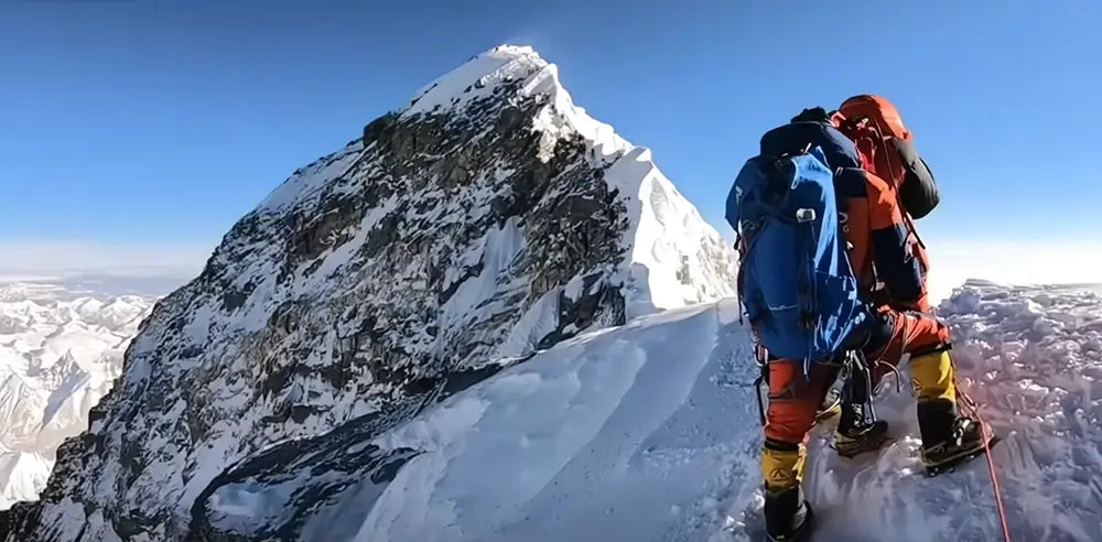
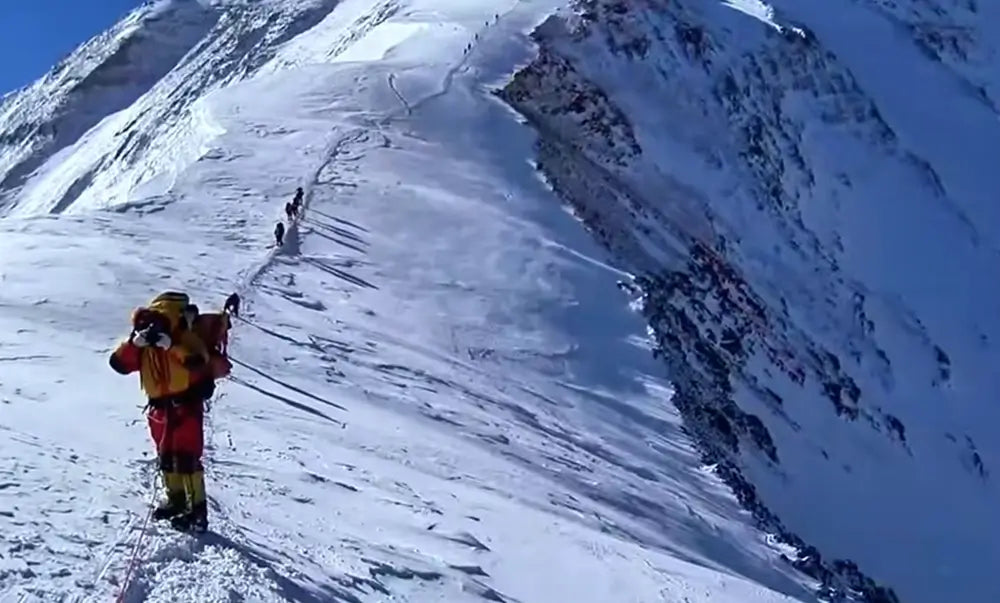
The Balcony is a key rest and oxygen change point. Above it, climbers continue toward the South Summit, then follow the exposed Southeast Ridge. The Hillary Step was once the most famous feature on this section, though its form changed after the 2015 earthquake. The area remains serious and exposed.
The summit itself is small. Climbers usually take photos, check their condition and leave quickly. Reaching the top is only halfway. Getting down safely is the real completion of the climb.
Why Descent Is So Dangerous
Many Everest accidents happen after the summit. The reason is simple: climbers have spent a huge amount of energy reaching the top, oxygen may be running low, weather can change, queues may slow movement and the body is exhausted.
Above 8000 metres, the body cannot properly recover. A climber standing on the summit may already be near the edge of their physical capacity. They still have to descend past the South Summit, the Balcony and back to the South Col before continuing lower.
This is why turnaround time matters. If the time is too late, oxygen is too low or weather is worsening, climbers should turn back, even if the summit looks close.
That sounds harsh, but on Everest, turning around can be the smartest success.
Who Is the South Col Route For
The Everest South Col climb is not suitable for people without serious high-altitude experience. Even though it is the most common commercial route, it is not a beginner route.
A climber considering the south side should normally have:
- High-altitude climbing experience
- Skills with crampons, ascenders, descenders and fixed ropes
- Strong endurance and fitness
- Expedition living experience
- Acceptance of serious risk
- Enough budget
- Reliable guide or expedition support
- The judgement to retreat when needed
For ordinary travellers, the Everest Base Camp Trek is a more realistic way to experience the region. The summit route is a very different undertaking.
Final Thoughts
The Everest South Col route is one of the most famous high-altitude routes in the world. From Nepal’s Khumbu region, it climbs through Everest Base Camp, the Khumbu Icefall, Camp 1, Western Cwm, Camp 2, Lhotse Face, Camp 3, Yellow Band, Geneva Spur, South Col Camp 4 and finally the Southeast Ridge to the summit.
It is classic, organised and supported by one of the world’s most developed high-altitude expedition systems. It is also dangerous, exhausting and unforgiving.
The real challenge is not one single section. It is weeks of making good decisions while living higher than the human body wants to be. Reaching the summit is remarkable. Turning around at the right time can be just as brave.

Leave a comment
All comments are moderated before being published.
This site is protected by hCaptcha and the hCaptcha Privacy Policy and Terms of Service apply.